‘Different Data for Mapping Detroit’s Cultural Landscape’—a hi/lo-fi data mash-up and workshop/exhibition by Patricio Davila, Dan McCafferty, Rachele Riley, and Joshua Singer.
[from Nordes 2015: Design Ecologies, ISSN 1604-9705. Stockholm, www.nordes.org]
Different Data is a collaborative critical design research project that through the assemblage of a diverse collection of data—concordant and contrasting—investigates the narrative space of the city with the intent of creating a counter-narrative using methods in design research, visual communication design, data visualization, and video. (see Van Toorn 1998, Hall 2011, Davila & Hadlaw 2011).
We combine open data sets with itinerant research in an experimental reworking of “ground-truthing,” (referring to the process of on-site research to aid in the calibration of data collected remotely.) Our goal is not to uncover truth, but to attempt to multiply and confound what emerges from data. It is a method of graphic design research as a mode of counter-production and critique that forms a space of inquiry from which one can critically view and reflect upon the cultural environment. Irreverent conclusions are a key component to the value of this critical project and its challenge to what can be considered legitimate research. As a foil to conventional research, speculative conclusions are an important form of creative thinking as imprecise and questionable associations generate new semantic connections and new forms of thinking and knowledge. (Lotman, 2000)
An important component to this work is the notion that the urban landscape is a complex and living ecology of flows, forces, and agents that takes form in realms of the physical, operative, psychological, and semantic. As James Corner states, “Materiality, representation, and imagination are not separate worlds; […] place construction owes as much to the representational and symbolic realms as to material activities.” (Corner, 2006) The urban ecology of Detroit is in an active state of flux as made evident by extreme movements of economic and cultural agency, and of material and psychic shifts (long-term and short-term) in response to global and local forces. Detroit, like other cities, struggles to balance or rectify these fluctuations.
In the Fall of 2014, we (the authors) participated in a residency at the Museum of Contemporary Art Detroit (MOCAD) in their Department of Education and Public Engagement (DEPE) in conjunction with DesignInquiry and its DesignCity program. We created a 2 x 7 meter layered wall composition and three-dimensional virtual environments as ways of presenting a view of the city through multiple paradigms. We mapped various narratives of the city, layering data gathered from diverse sources: open datasets, historical maps, field collections of visual and GIS data, and data generated through studio-based experiments. Outcomes included visualizations of ‘unknown’ city parcels, large collections of typographic typologies from the urban landscape and imaginary structures that delineate hidden pasts. Rather than examining discrete and specific issues, we used various datasets, intrinsic and enigmatic, conventional and marginal, and made irreverent connections among them, revealing other realities of the city. The ultimate goal was not to create a single ‘seamless’ (Manovich, 2006) artifact since complex and fragmented realities of today’s systems do not allow for a seamless experience. Instead, we believe we should pay attention to the seams and necessary disruptions: aiming at cities that maintain, as Mark Weiser puts it, “seamful systems, with beautiful seams.” (Lynch, 1991)
The project at MOCAD included a distinctive performative act in a public space. This approach turns the process of design into an exposition of itself. It demonstrates that giving data form—deciding what is used or discarded, and how it is experienced—is a creative, experimental, and subjective process. (Pickles 2004)
Corner, J. (2006). Terra Fluxus. In C. Waldheim (Ed.), The Landscape Urbanism Reader (pp. 21–33). New York: Princeton Architectural Press.
Davila, P., & Hadlaw, J. (2011). Spatial Resistance: Design and Critical Mapping Practices. Presented at the Design History Society Annual Conference - Design Activism and Social Change, Barcelona.
DiSalvo, C. (2012). Adversarial Design. MIT Press.
Friedlander, E. (2008). The Measure of the Contingent: Walter Benjamin’s Dialectical Image. Boundary 2, 35(3), 1 –26.
Hall, P. (2011). Bubbles, Lines, and String: How Information Visualization Shapes Society. In A. Blauvelt, E. Lupton, & R. Giampietro (Eds.), Graphic design : now in production (pp. 170–185). Minneapolis, MN; New York: Walker Art Center ; Distributed by D.A.P.
Lotman, Y. M. (2000). Universe of the Mind: A Semiotic Theory of Culture. (A. Shukman, Trans.). Indiana University Press.
Lynch, K. (1991). Wasting Away - An Exploration of Waste: What It Is, How It Happens, Why We Fear It, How To Do It Well. Random House.
Manovich, L. (2006). Image Future. Animation, 1(1), 25–44.
Pickles, J. (2004). A history of spaces : cartographic reason, mapping, and the geo-coded world. London; New York: Routledge.
Toorn, J. van, Barrett, D. B., Brouwer, M., Jan van Eyck Akademie, & Design beyond Design (Symposium) (Eds.). (1998). Design beyond Design: Jan van Eyck akademie, 7 and 8 november 1997. Amsterdam: Jan van Eyck Akademie : Maastricht & De Balie.
Getting started for the first week of on site work in the museum.

360º view of Detroit from a central axis of MOCAD. Viewing the city fro a single POV(from this POV.)
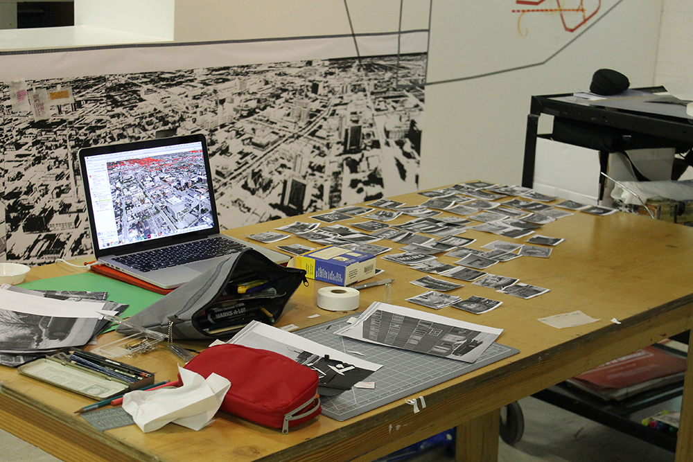
Working on site, during museum hours, in the space. Going from datasets in Google Earth, to B&W printouts of image data, to pencil, to marker.

In action (note me tracing directly from laptop screen!)

The beginnings of "Typographic Typologies" - collection of typographic data points from specific geographic nodes of the city of Detroit.Printed and trimmed and color coded according to location.

Organizing the data points in clusters on two axes that indicate levels of aesthetics and and cultural value.

Detail

Typological organization on two axes. Left to right: Levels of cultural authority. Top to bottom: Levels of aesthetic value.

Students from OCAD and Wayne State University working on the transposition of the 360º landscape onto the wall, in prepearation for Particio Davilla and Dan McCafferty's work displaying water use.

Rachele Riley annotating a map with data from Data Driven Detroit's (D3) "Motor City Mapping parcel survey report http://d3.d3.opendata.arcgis.com/datasets/7cfed5afb7654e2495ef4c1ead320aa5_0 indicating unknown spaces.

Detail of final wall composition, showing layered data including color coded typographic typologies and water use data.

Detail with historic map showing geographic nodes used as survey areas in both typographic and unknown space data.

View of completed wall composition.

Still of prototype video "Intrepid" from data collected during the February expedition of DesignInquiry/DesignCity http://designinquiry.net/projects/detroit/ a dérive by automobile (apropos to Detroit) (with Chris Fox https://www.linkedin.com/pub/christopher-fox/4/a69/31), and the visual collision of historical and contemporary maps.

Still of final video "Intrepid" in collaboration with Rachele Riley. Layers of historic maps, georeferenced images from the February dérive, shape data for unknown city parcels, and giant 3D monumnets (mode - rnism) planted over buried streams.


